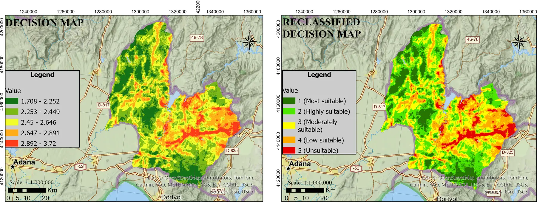
From map to decision model
For a school, hospital, green space, energy facility or disaster assembly area, the question “Where is the most suitable location?” may initially appear to be a technical site-selection problem. Yet every spatial decision simultaneously involves competing criteria such as accessibility, cost, population, environmental thresholds, ownership, risk, equity and public interest. None of these criteria is independent of location.
This is precisely what continues to make Geographic Information Systems (GIS) indispensable. GIS does more than combine data from different sources on a map; by using spatial relationships, it turns data into information that can be compared, tested and used to support decisions. GIS should therefore be understood not as a map-drawing tool, but as a framework for reasoning and governance that brings spatial data infrastructures and decision models together.
- Define the decision problem: Clearly specify the objective, study area, constraints, decision unit and alternatives.
- Build the spatial data infrastructure: Prepare population, transport, land-use, topography, environmental sensitivity, hazard and ownership layers within a common framework of coordinates, scale and currency.
- Model the criteria: Convert variables such as distance, travel time, density, slope, capacity and risk into measurable indicators.
- Apply decision rules: Evaluate alternatives through methods such as AHP, TOPSIS, entropy weighting, fuzzy logic, game theory or machine learning.
- Validate and test sensitivity: Examine how strongly the result depends on particular data, thresholds and weights, and verify it using field knowledge and expert judgement.
If any link in this chain is weak, it is possible to produce a visually persuasive map, but not a reliable decision. Good GIS practice makes data quality, assumptions and uncertainty visible before presenting the final map.
The cost of asking ‘where?’ in public investment
A poor location choice in public investment does more than increase initial construction costs. It can create long-term consequences such as unequal access to services, low capacity use, longer journeys, environmental harm and new disaster risks. GIS enables demand and supply to be examined within the same spatial framework, existing service areas to be calculated through network analysis, and underserved locations to be identified.
Online multi-criteria spatial decision-support systems can compare levels of service for schools, pharmacies, supermarkets and similar public services by modelling accessibility, capacity and distance reduction together. The crucial point is not a particular software package, but the ability to modify decision criteria and recalculate results. A one-off static analysis can thereby become an institutional decision process in which alternative scenarios are openly discussed.
Reading relationships—not merely layers—in urban planning
Cities are dynamic structures where transport, housing, green infrastructure, energy, climate and social systems overlap. The strength of GIS in planning lies less in displaying these layers separately than in revealing their relationships. A new transport line can be assessed not only in terms of travel time, but also for its effects on land value, pedestrian movement, emissions and vulnerable groups within the same spatial framework.
This approach is reflected in the research agenda to which I have contributed across different decision problems. GIS-based AHP and TOPSIS assessments of green-space suitability, the selection of cycling and walking routes for sustainable transport, spatial evaluation of school sites, and identification of proxy features for geotechnical measurements across large areas all reveal a common core: combining multi-source data through explicit decision criteria while preserving spatial relationships.
Current research expands this framework through machine learning and game theory. In green-space management, school siting, energy-facility planning, seismic vulnerability and the effects of climate conditions on walkability, GIS is becoming more than a platform that describes current conditions. It can learn patterns, rank alternatives and compare competing priorities through scenarios.
Are GeoAI and digital twins replacing GIS?
No. Artificial intelligence, big data and urban digital twins do not make GIS redundant; they increase the need for a robust GIS infrastructure. Neither a machine-learning prediction nor a stream of sensor readings is independent of positional accuracy, temporal alignment, scale, topology and data-provenance issues.
GeoAI can produce powerful predictions, but the question “Why was this investment recommended here?” cannot be answered by an accuracy score alone. Public decisions require explainability, fairness, regulatory compliance and the possibility of challenge. GIS provides this basis for scrutiny by relating model output to population, property, environment, risk and service areas. The future is therefore not a choice between GIS and AI, but explainable GeoAI operating on a well-governed spatial data infrastructure.
Participation: Spatialising citizen knowledge
Expert data alone is not enough for planning. Streets people consider unsafe, everyday routes they use, places where they experience heat stress and the services they need are often absent from institutional databases. Map-based surveys and participatory GIS methods connect experiential knowledge with location and make it available for analysis.
Online map-based participation tools make it possible to reach more people earlier and examine citizen input alongside a municipality’s existing GIS layers. Yet collecting data is not participation in itself. If it is unclear how participatory data affects a decision, the map becomes little more than a digital suggestion box. Its real value emerges when citizen knowledge is explicitly connected to decision criteria and outcomes are shared through a feedback process.
GIS is not the decision; it is the decision’s auditable infrastructure
The power of GIS does not automatically produce the right decision. Criterion selection, weights, data dates, spatial resolution and exclusion thresholds directly influence results. A responsible GIS-based decision process should therefore be able to answer the following questions:
- How current are the data, and at what scale are they reliable?
- Who selected the criteria and weights, and on what grounds?
- How much does the result change under different weights?
- Does the model make effects on disadvantaged groups visible?
- Has the decision map been tested through field validation?
- Can the analysis be reproduced when the data and model are updated?
These questions transform GIS from a technical back-office application into an instrument of institutional accountability. Especially in public investment, documenting the analytical process makes not only the outcome but also the reasoning behind a decision auditable.
Conclusion: What is indispensable is not the software, but spatial thinking
The indispensability of GIS does not stem from a particular desktop application or an impressive map. Its real value lies in asking where, for whom, how much, under what risk and at what opportunity cost within the same analytical framework.
GIS establishes a shared language between data, methods and governance for directing public resources to the right places, comparing urban-planning scenarios, reducing disaster risk and strengthening climate adaptation. Artificial intelligence and digital twins can enrich this language. Without reliable spatial data, explicit decision criteria, sensitivity analysis and field validation, however, technology merely produces uncertainty faster.
The central question today is therefore not “Do we still need GIS?” It is this: Can we use GIS to make our decisions more transparent, equitable and reproducible?